I have been researching the history of landownership of a west to east geographic slice of north Lancashire, from the sea coast at Cockersand Abbey to the moorland at the Trough of Bowland. Further information.
I have made some prints based on this study. These prints are based on three historical sources of information about landownership in England: Tithe Commutation (approx 1825-1850), the Land Valuation Survey (1910-1915), and the Land Registry (2025).
The prints based on small sections of tithe maps and valuation maps were printed with mud from the estuary of the river Lune. Those based on Land Registry information were printed with sand or peat from the location identified.
Landownership is an example of current global economic inequalities. It is estimated that 50% of the land in England is currently owned by less than 1% of the population.
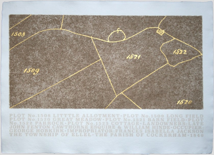
Township of Ellel. Parish of Cockerham. 1846.
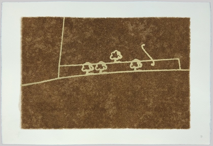
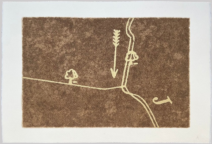
A series of images based on small sections of 19th century tithe commutation maps. Screen-printed in mud, and gold acrylic, with hand-painted gold.


Over the past few years I have been researching the history of landownership of an area near where I live. The selected area is a west-east slice of north Lancashire from the remains of Cockersand Abbey on the sea coast, to the moorlands at the Trough of Bowland. More details can be found here.
The above six prints are based on small sections of Tithe Maps for this area which were produced in the mid nineteenth century, and which show the names of the owner and occupier of every plot of land. They were screen printed with mud from the estuary of the river Lune, close to where I live, and the details screen printed and/or hand-painted with gold acrylic.
.
Map Fragments
Three screenprints of details from maps showing landownership boundaries used in the national Land Valuation Survey of 1910, were printed with gold acrylic and mud from Glasson Marsh on the estuary of the River Lune.

.
Specific Collection Sites
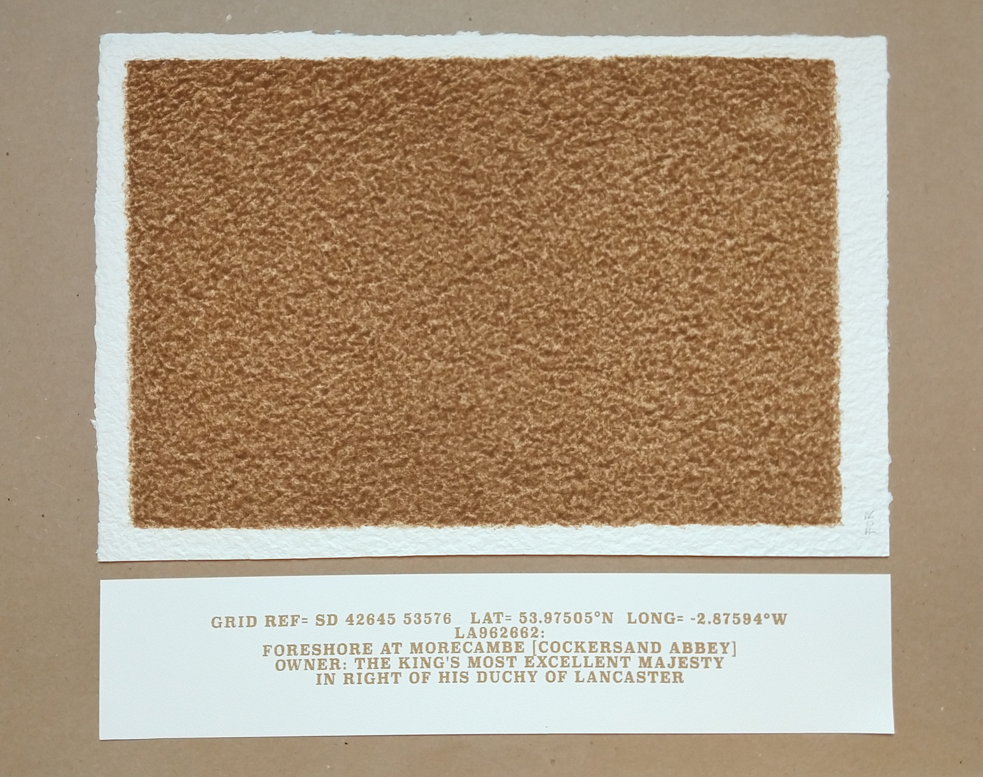
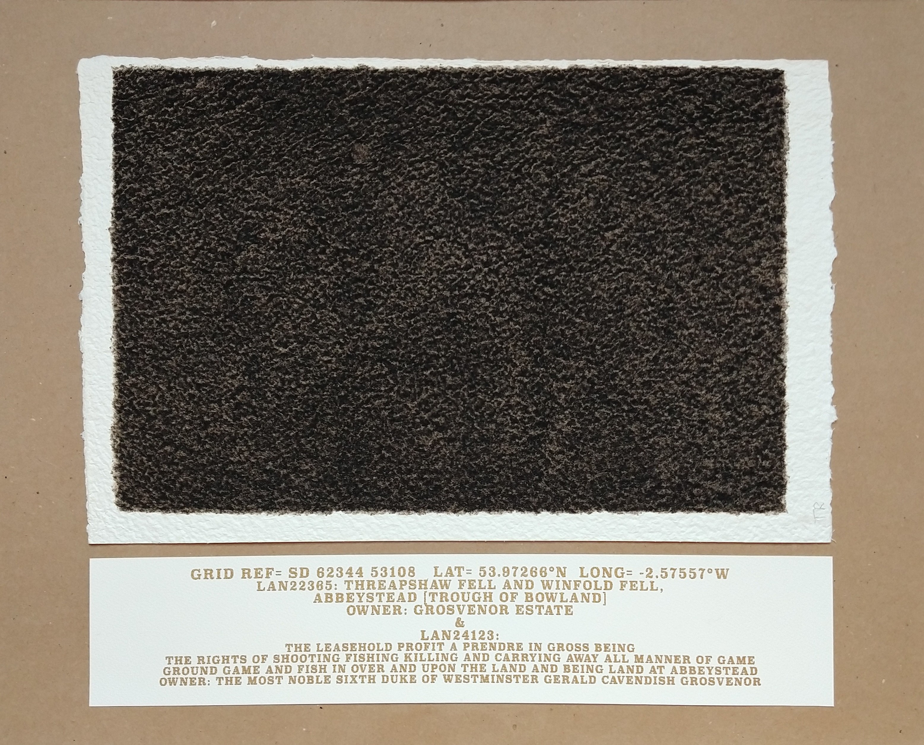
Sand, soil, or peat was collected from particular locations in the study area and used to create a series of screenprints.
Each work is in two parts: a screen-print on textured paper, printed with soil ; and a second, screen-printed with gold text, giving the exact geographic location of the collection site, its Land Registry reference number, its description, and the owner of the site.
The two reproduced here show the two ends of the geographic slice.
These soil prints are tiny plots of land.
.
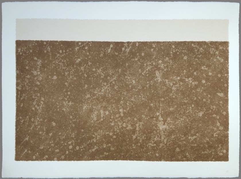
Lune Estuary Glasson Marsh mud
These two screenprints are from a series made with mud collected from Glasson Marsh on the estuary of the River Lune near Lancaster. This location is near to but outside the study area, but it was the initial source of material for all these prints.
.

.
.
